A short history of flooding in Fishlake.
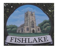
The village of Fishlake lies adjacent to the lower reaches of the River Don in South Yorkshire. The placename Fishlake comes from the old English Fiscelac, Fixcale (1086 Doomsday Book), meaning Fish stream which of course refers to the River Don.
This location close to a major river provided advantageous benefits such as ample supply of water and food. In addition there were significant benefits to local economics, trade and transportation. Consequently the opportunity to develop a small inland port was not missed contributing to the overall economic growth of the township which is reflected most obviously in the size of the church building with its architectural richness. From the Doomsday Survey through various subsequent medieval records shows Fishlake to be a prosperous community as consequence of its riverside location.
Due to the low lying nature of the regional geography steps had already been taken in past centuries to manage surface water logging through various techniques including diking, embanking and agricultural practices.
It is therefore assumed that existing land drainage arrangements known today as Taining drain, Clay Dike, Green Dike, Boating Dike (now filled in), Trundle and Sour Drains were adequate to manage local land drainage requirements. Supported by the existing ridge and furrow field drainage techniques. Equally river banking precautions provided additional satisfactory protection from the possibility of flooding.
Nevertheless, we are made aware from contemporary records that flooding did in practice restrict movement within the community. For example, we read from the Yorkshire Chantry Survey vol 1 of 1546 as published by the Surtees Society. Regarding the Chantry of the Trinity and the Chapel of Dowsthorpe in the said parish of Fishlake. "The same is distant from the said church two miles or more. The necessity is there is divers great waters oft-times that the inhabitants there can by no means come to the said parish church".
Local township management through the Bylaw Court saw that bankmen were appointed yearly, at least from 1591, their function was to ensure the ancient banks were secure and properly maintained. There is a late 17th century petition stating that the Fishlake earthen river embankments before the 1630's were only 3ft high and their cost of maintenance yearly was £8.
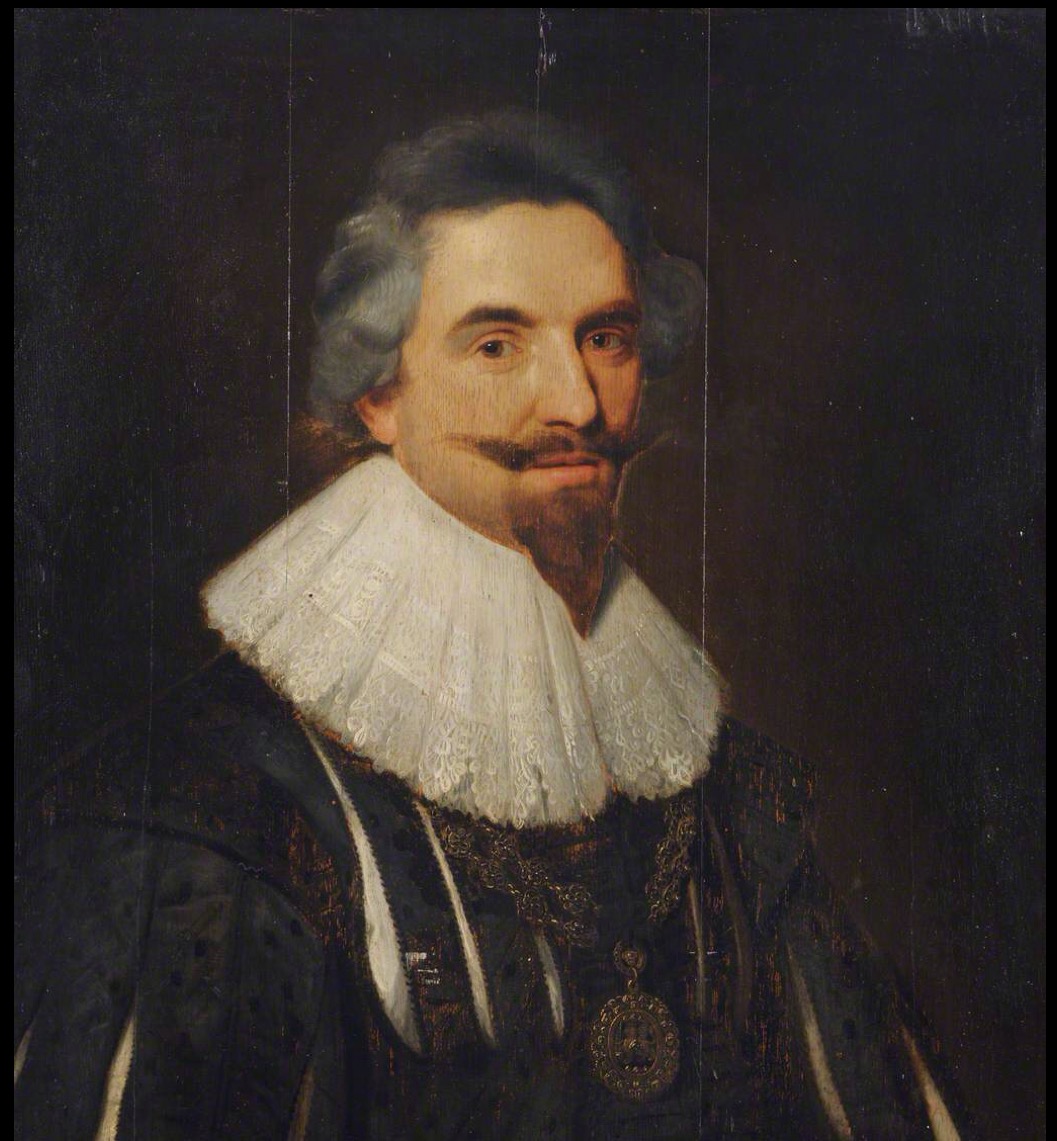
Before the 17 th century there is no obvious evidence that the village itself suffered from significant flooding. However, human intervention during the early 17th century created radical changes to the local landscape due to substantial drainage work undertaken to the south and East of Fishlake and the river Don. This came about when Charles 1 st commissioned a Dutch engineer, Cornelius Vermuyden, to undertake reclamation work to large proportions of waterlogged land by draining Hatfield Chase, a large area which including Thorne and the Isle of Axholme. The benefits come from the acquisition of drained agricultural land that could then be distributed for profit, a third to the Crown, a third to Vermyden and a third to the inhabits. In some areas the project can be viewed and a success story. However there was an unforeseen negative side effect, the drainage project caused a great increase in the chances of flooding on the northern bank of the Don. This was due to the raising of Ashfield bank on the South side and by cutting off the Southern arm of the two courses of the river which encircled Ashfields. This forced the river to flow into the Northern arm against the Fishlake bank. More seriously, by cutting off the Don completely from its ancient route through the Levels at Thorne and forcing its total flow into the medieval Turnbridge Dike (running north to Goole) it produced a situation with which neither the Dike nor the ancient low banks at Fishlake could cope.
Below. This is the man Sir Cornelius Vermyden who Fishlake folk love to hate.
Unfortunately for those living on the north side of the Don mistakes made during the planning and undertaking phases resulted in catastrophic flooding in Fishlake. So much so that the drainage and subsequent flooding produced a five year gap in the Bye-law court book records, between 1625 and 1630 inclusive.
Consequently this resulted in long legal struggles by the inhabitants of Fishlake (and other affected areas) which forced the drainage engineers to open a channel to the Ouse (know as the Dutch River) and to raise the Fishlake bank to an adequate height. The ongoing struggle continued through the 17 th century with the Participants (the financiers of the drainage and their successors). Even then Fishlake inhabitants had to pay annually to maintain the banks.
Over the following decades and centuries numerous accounts exist of flooding events in the village. The following are some notable examples:
From the Diary of Abraham De La Pryme as reproduced in Tomlinson's Levels of Hatfield Chace and Part Adjacent. "1697 December 17, 18, 19, 20. On the 17th of this month wee had a very great snow which was on the level ground about 2 foot and a half thick after a pretty hard frost which as it thawed froze again for several days. The 20th it thow'd exceeding fast upon which there came so a great flood down that the like was never known. About forty one years ago there was then the greatest flood that was ever remembered, but that was much less than this for this came roaring all of a sudden about 11 o'clock at night unto Bramwith, Fishlake, Thorn and other the towns upon which the people rung all the bells backward (as they commonly do in case of a great fire) but tho' that this frighted all and called all the banks and bid them all look about them yet nevertheless the loss is vastly great. The people of Sikehouse and Fishlake though they had banks to save them yet it tops all drounded the people's beasts in their folds and houses destroyed sheep and several men lost their lives their houses in sikehouse and many in Fishlake being drownded up to the very eaves so that they reckon no less than £3000 damages to be done by the same in the parish of Fishlake.It was indeed all all over a very sad thing to hear the oxen blowing and the sheep bleating on the people crying out for help round about as they did all Bramwith, Sikehouse, Stanford and Fishlake over (as undoubtedly they did in other places) yet no one could get to save or help them being about midd night and so many poor people are forced to remain for several days together some upon the top of their houses others in the highest rooms without meat or fire until they were almost starv'd".
The following accounts may well have effected Fishlake too. Tomlinson records several flooding memorandums taken from Thorne Parish register. 1681 January 15 th "a great flood, with high winds". Also in 1682 April 27 th. 1696 13 th December. "that great flood came on very suddenly and the highest that has been known". 1701 January 18 th " that a great flood then came down". 1706 18 and 19 th July. "There was a great flood".
1795 12 February a great flood was recorded in the Fishlake township account book as follows,
"Memorandum that this Book as well as most of the Writings belonging this town was very much Damaged by the great Flood of water which happened on the Eleventh day of February One Thousand seven hundred and Ninety five The said Book and Writings being then in the Town Chest in the School House, which said Chest was over flowed with water several inches above the lid or cover of the same, and also was two foot deep in several Houses, and in some Houses several inches above two foot, and the said Flood perished and drowned several Horses, beasts, sheep, pigs & in the parish, as well as greatly damaging Corn, hay, Clover & in the Barn and Stacks too tedious to mention here in particulars... This memorandum drawn into the book by desire of several Neighbours, the 20 th of the said instant February 1795. By me Richard France." ( now in the Doncaster Archives).
1846 a major flooding.
1872 a major flooding.
November 1880 a great flood. (an account taken from Tomlinsons, Hatfield Chace and Parts Adjacent). In early October continued rain caused considerable inundations from dykes and small streams. In Fishlake many thousand acres of land were submerged to the depth of one to three feet including the village, farmsteads and stacks. Worse than the great flood of 1872. On Sunday 31st October church service suspended due to access. Boats and rafts were used to convey families to safety. Cattle moved to high ground but there was a loss to a variety of arable crops.
1886 Tom Smith, Chair of the Parish Council at the time, recorded in a later newspaper article that flood water in the village was 9 feet deep in some places as bad as it was in 1846. In 1886 cattle had to be moved to safe ground and some people had to abandon their homes for a time.
1904. A major flood in this year was recorded in some detail by the Doncaster Gazette on 4 Feb 1904… “During the past week Fishlake has had an unpleasant reminder of the floods of eighteen years ago. The heavy rains last week, combined with successive high tides in the Don, caused the river to overflow to a large extent. On Thursday and Friday the water rolled over the banks from Stainforth to Low Hill with great force, turning the Town Ings and the Nabb into a couple of lakes, thus showing that those who gave the village its name did not do so without reason. The highway to Stainforth was submerged deeply, and traffic back passed on with difficulty on Saturday morning but few dared to face it back again returning mostly by Askern. The highway to Thorne was also covered, though not so deep ns the former. Unfortunately, the mischief did not stop here. The Shuttlebridge Clough through the barrier bank, which protects, or should protect the village, had its door wedged partly open by a large stone, doubtless placed there in summer to allow the tidal water to fill the ponds, etc. Through this opening the overflow rushed up the village drain during Thursday night, and covered the roads and footpaths in many places. The obstacle was got out on Friday morning or the consequences would have been very serious. As it was, some of the lower lying farmsteads were inundated and most of the roads and footpaths had water over them in places, so that communication from one part of the village to the other was kept up by dodging the enemy and making tracks here and there upon higher ground. The water reached its highest on Sunday, when the fall in the river water allowed the Taining Clough to run and the flood on the Nabb began to subside. The Low Hill sluice also began to run, and by Tuesday most of the footpaths were again passable. With the Nabb water, however, a great change took place. After subsiding throughout Monday, a rapid rise occurred during the night, and at the time of writing on Tuesday the water is within a few inches of being as high as the highest on Sunday. The rise of the tidal river would of course check the outflow, but the rise on the landside shows it must receive an immense feed from the Bramwith district. As we write, the flood is rising and the rain falling, so that now communication between Fishlake and Stainforth looks like being suspended for some days.”
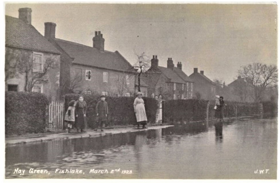
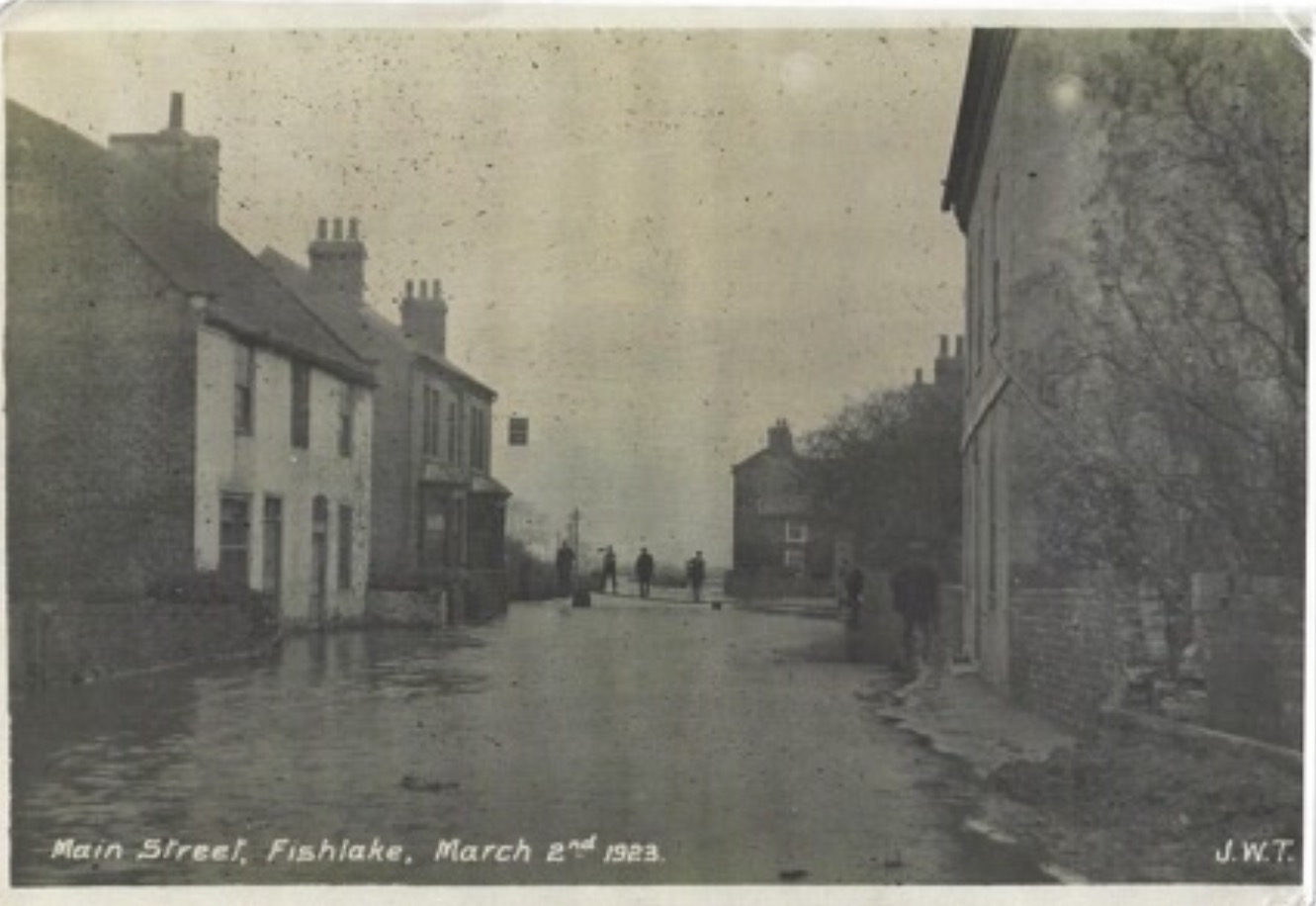
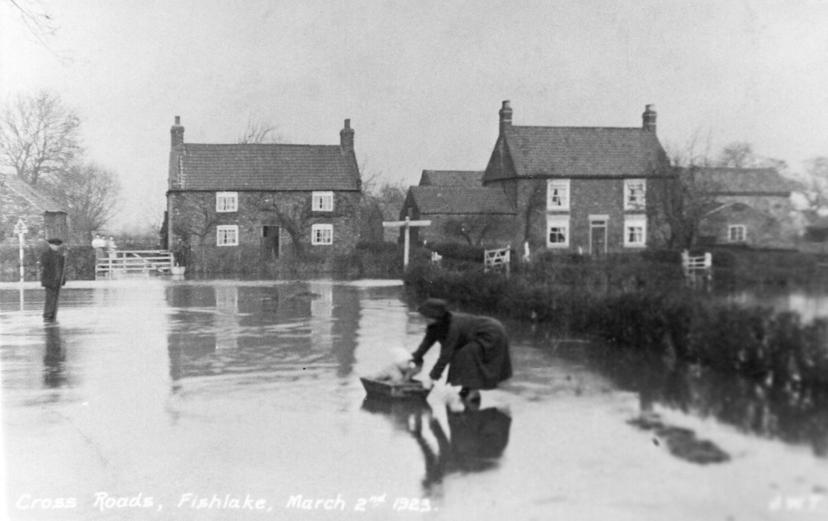
1923 March 2 nd a number of photographs (perhaps the earliest) recording extensive flooding in the village.
Hay Green Corner 2 nd March 1923.
Below Nab Road Flooded 2nd March 1923. See the make- shift bridge erected across the road.
Below Haygreen Junction afloat in a bath 1923.
Below the flooding Wednesday January 11 th 1928 as recorded in a regional newspaper
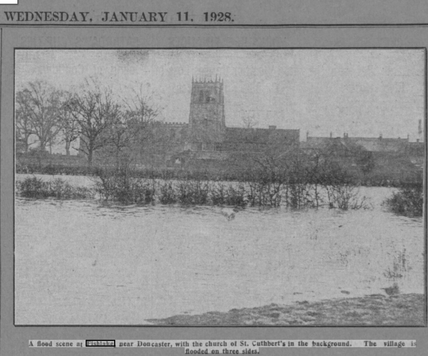
1928 Newspaper reports flooding on three sides of the village.
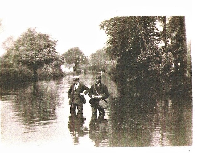
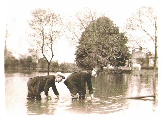
1932 May 20 -23 rd also a photographic record of flooding in the village. On that occasion Fishlake was flooded for 16 days in some parts up to 9 feet deep according to newspaper reports. During a period of 30 hours of constant rain.
Below David Duckitt left and Percy Smith, postman right larking about in the flood of 1932.
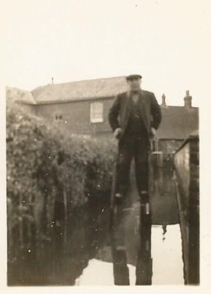
Below. Some residents of Fishlake took to stilts! Date and person is unknown.
Over the years many new drainage schemes were proposed but not undertaken.
1930 saw the Land Drainage Act when the responsibility for the whole system of tidal and flood defenses was placed with two Boards, the River Ouse (Yorkshire) Catchment Board and the River Trent catchment Board. In 1933 major improvements were planned to the river Don between Doncaster and Goole including widening, deepening, raising flood banks, work began before the war and finished in 1953 at the cost of £1,500,00.
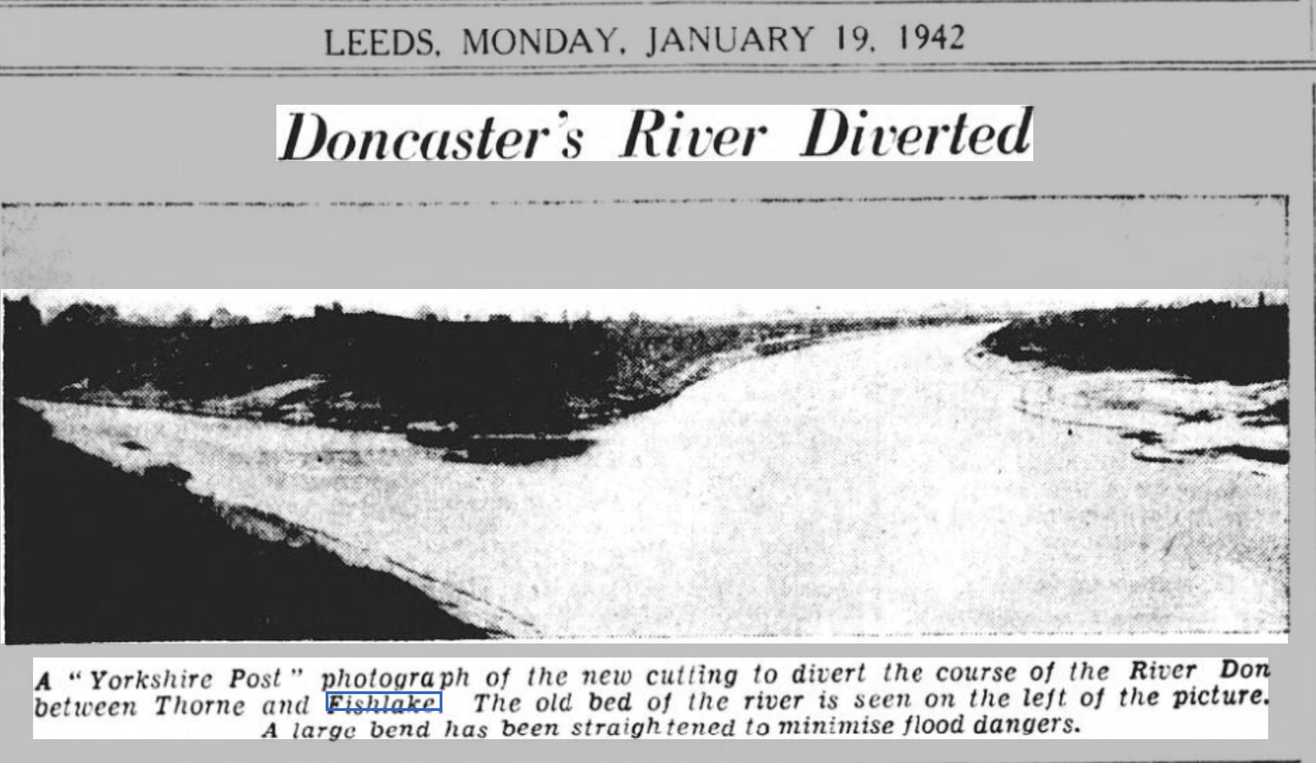
1942 River Don diverted to reduce the risk of flooding in the village.
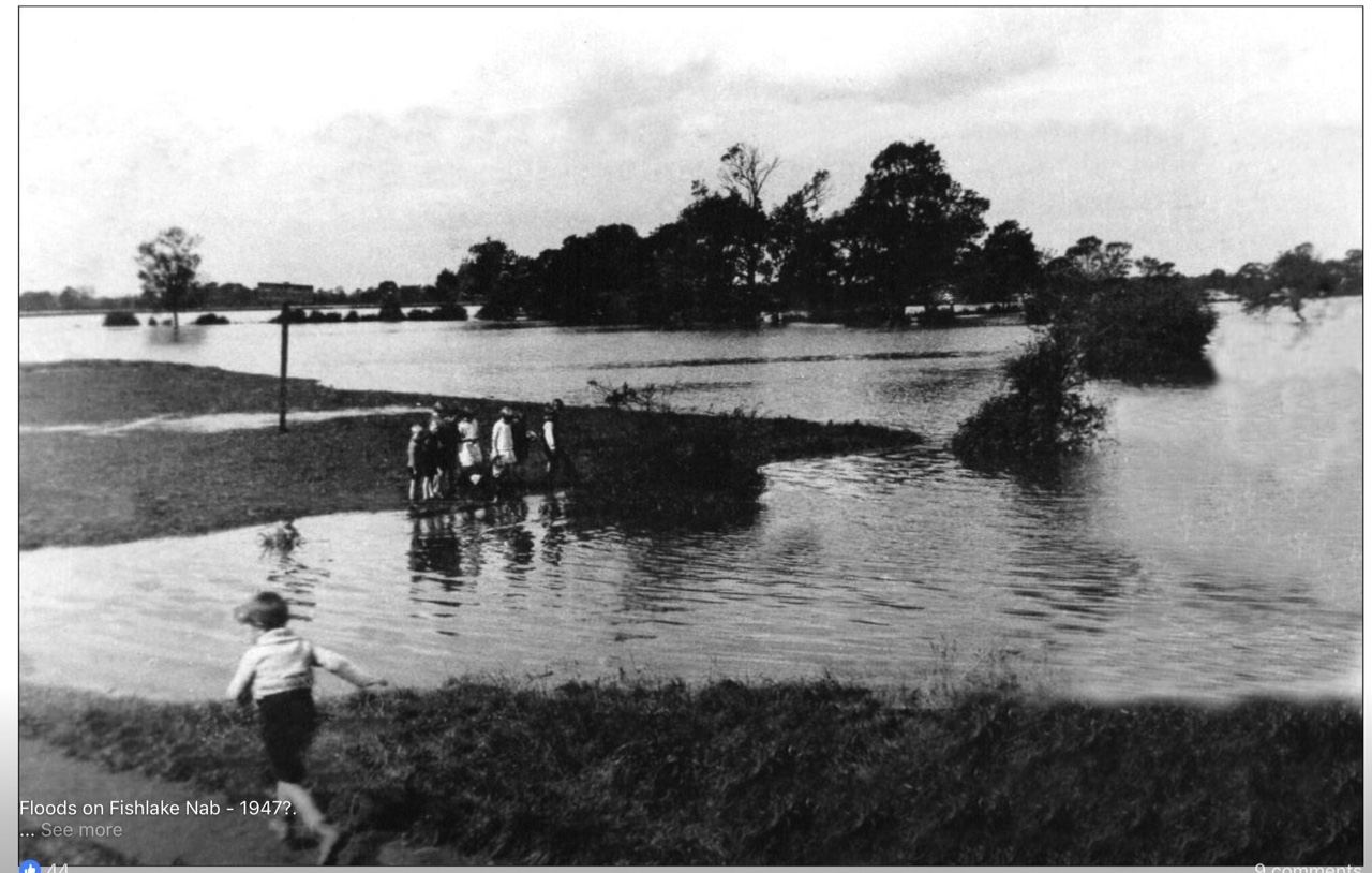
1947 Snow melt from the great freeze followed by flooding.
The Nab under water in 1947.
No major flooding after 1947 which was the last time Fishlake residents had to leave there village.
Before the use of sandbags houses at risk of flooding constructed 'latt' on gates and doors to prevent flood water entering gardens and properties. These 'latts' could still be seen at several houses on the bank in 1970's.
2000 November. A threatened flood. Fishlake saw sandbags and evacuation. Thankfully the flood defenses held and avoided devastation seen elsewhere.
2007 River Don very high.
2012 7 th July River levels at 6.47. maximum by new recording devices.
2015/16. River Don very high.
Once again in 2019 Fishlake village was inundated with water following a long and persistent rain fall. This situation was made worse by significant flood defenses which had been put in place higher up the river at Sheffield following the devastating flooding 12 years earlier (2007). It is now confirmed that there had been 77.8 mm ( 3.1 inches) of rain during a twenty-four hour period over 7 and 8 November.
There are full accounts of these events online and in newspapers.
November 2019.

"Everyone has a different opinion on why our village flooded. Was it a lack of dredging for many years, the fact that Sheffield had increased its flood protection, the fact that Fishlake's river banks are lower than those opposite, the disappearance of many drains and ditches or simply the fact that we had two months' worth of rain in a day and the resultant water combined with a high tide pushed the water towards the village?" Thanks to Stephen Cook Fishlake Findings 29 th November 2019.
Ironically this is a similar situation to what happened almost 400 years earlier when drainage improvements in the adjacent parishes (as described above) caused devastation to Fishlake village and its inhabitants.
Biography.
Tomlinson John Level of Hatfield Chace and Parts Adjacent. 1882.
Byford D. Open Field Farming in Fishlake and Hatfield: in Aspects of Doncaster. 1997.
Cook S Fishlake Findings.
Fishlake The Story of a South Yorkshire Village 2000
Flood. The stories of a village underwater. 2021.